QGisRasterCatalog
Dernière modification : 2009/08/21 22:13
About
Installation
What's needed ?
rasterCatalog 0.2
From archive
From SVN
Getting started
Usage
Start
Map tab
Database tab
Configuration tab
Scan
Paths
Licence
ToDo
Bugs
Old versions
rasterCatalog 0.1
About
This application can be used as a standalone app based on QGis API, but also as a QGis plugin.It will allow you to easily find raster maps corresponding to geographic coordinates.
See more screenshots
Installation
What's needed ?
rasterCatalog 0.2
You will need :- QGis with python bindings (tested with QGis 1.0.2 on Ubuntu Jaunty)
- PyQt
- Sqlite
From archive
Download rasterCatalog_0.2.tar.gzExtract to your python plugins directory
eg: /usr/share/qgis/python/plugins/ for all users
~/.qgis/python/plugins/ for only one user
Activate the plugin via the plugin manager.
See QGis documentation for more details.
It should work with plugin installer, please report any malfunction. (buggerone (at) gmail (dot) com)
From SVN
Check out the current trunksvn co svn://svn.tuxfamily.org/svnroot/scrippets/scripts/trunk/qgis/rasterCatalogor a tagged version.
svn co svn://svn.tuxfamily.org/svnroot/scrippets/scripts/tags/qgis/rasterCatalog/0.2Use make to install it to ~/.qgis/python/plugins/rasterCatalog
You can also browse source code.
Getting started
First you will need to scan some directories to find raster maps :- go to the Configuration tab
- add some directories to scan via the + button
- to create thumbnails of your maps, check the Generate Thumbnail box
Then go back to Map tab
Click on the button showing a map and choose a point in the world map.
When a point is choosed, list of maps containing this point is displayed in the Rasters maps list.
Clicking in this list will :
- display the thumbnail of this map if existing
- allow you to show this map in the map zone
- let you Add it to QGis as a new layer (if used as a plugin)
Usage
Start
If used as a plugin, add it with QGis Plugin manager. Start it by clicking on the map button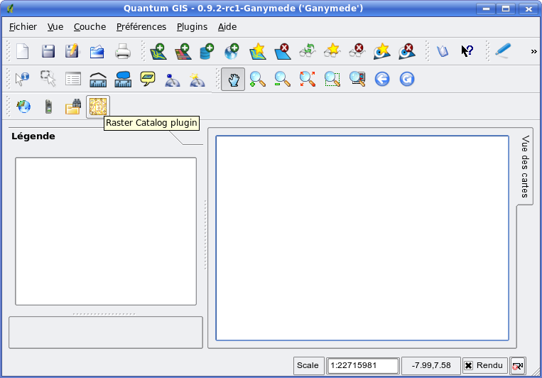
To use as a standalone application, just launch rasterCatalog.py from the installed dir :
python rasterCatalog.pyMap tab
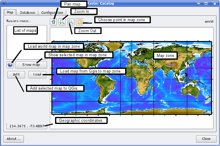
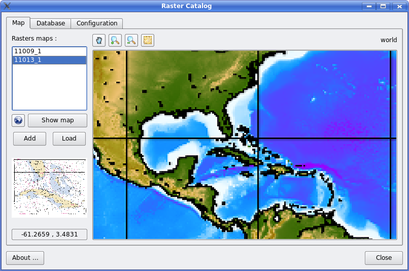
This is the principal tab.
On the right side :
- Tool bar
- Pan the displayed map
- Zoom in the displayed map
- Zoom out the displayed map
- Choose a point in the displayed map and then search for maps containing this point
- Map zone : display the current map (a world map by default)
- Rasters maps: List of maps containing the selected point
- buttons :
- world: go back to the world map
- Show map: display the selected map in Rasters maps to map zone
- Add: insert the selected map to QGis
- Load: load the QGis selected layer into map zone
Database tab

This tab allow you to show the list of known maps
- Load: load the database from disk (~/.qgis/rasterCatalog.sqlite)
- Show map: load the current selected map to map zone in Map tab
Configuration tab

Scan
- Maps directories: list of directories containing raster maps
- +: add a new directory
- -: remove the selected directory
- Maps extensions: list of file extensions to be searched for. Extensions are without dot and separated by comma. They are not case sensitive.
- Generate thumbnails: check to create little images of each map
- Start scan: scan directories for maps and add them to database. A progress bar is displayed during thumbnail generation.
Paths
- Storage path: directory where thumbnails will be stored
- GMT path: not yet used
- Imagemagick path: not yet used
Licence
This application is licensed under GNU GPLv2
Some credits goes to :
- Aaron Racicot for http://blog.qgis.org/?q=node/107 and http://blog.qgis.org/?q=node/104
- Martin Dobias for http://blog.qgis.org/?q=node/59
ToDo
Quick list of future improvements :
-
make it compatible with QGis 1.00.2 - interface to GMT for map generation
- display selected raster map box in map zone
- l10n / i18n
- allow DB modifications from the interface
-
coordinate reference system0.2
-
-
also import the projection in QGis0.2 -
replace QSql by sqlite30.2 - compatibility with windows
- need more testing
Bugs
- crash with QGis < 1.0.2 when doing multiple scans
Old versions
rasterCatalog 0.1
- Download rasterCatalog_0.1.tar.gz
- QGis with python bindings (tested with QGis 0.9.2rc1 on Ubuntu Gutsy)
- svn trunk should work with QGis 1.0
- PyQt (tested with 4.3.2)
- QtSql
- Sqlite (tested with 3.4.2)
2025/06/11 21:08 -- 216.73.216.110